

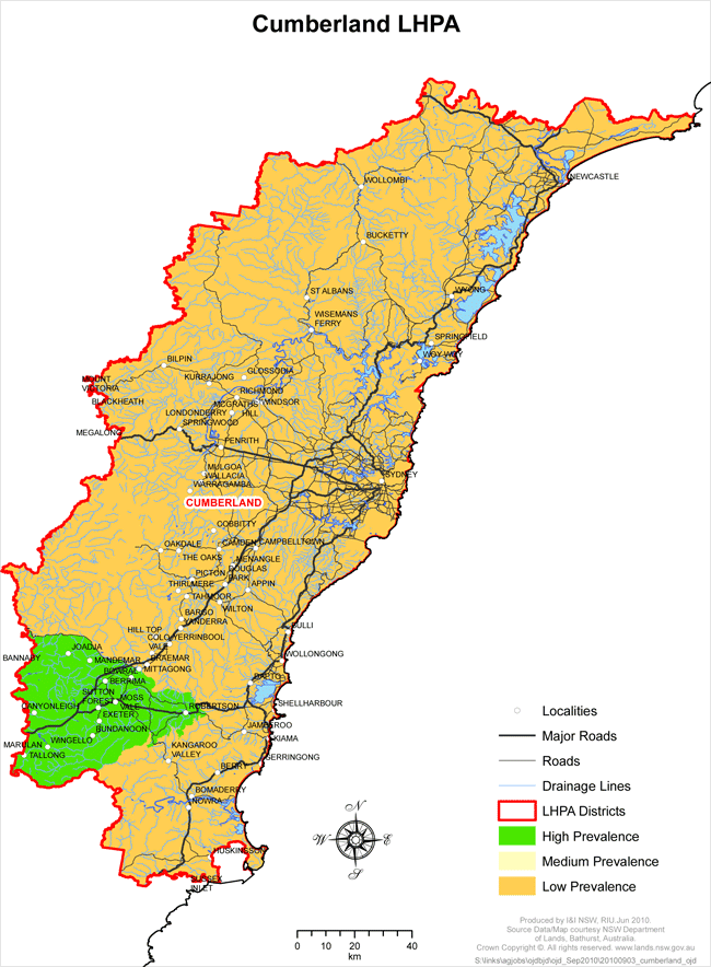
Cumberland LHPA - OJD Prevalence Areas
View large version of map (1.4 Mb PDF)
High Prevalence Area (HPA)
That part of the Cumberland LHP district from the western boundary at the intersection with Wombeyan Caves Road and following that road east to Mittagong, then Range Road and Tourist Road to the Illawarra Highway junction near Robertson, then north to Macquarie Pass. From Macquarie Pass, follow the line of the escarpment south and west to Fitzroy Falls. From the falls, follow Yarrunga Creek south to the intersection with the Shoalhaven River, then follow the Shoalhaven River west to its intersection with the western boundary of Cumberland LHPA district near Marulan South.
Low Prevalence Area (LPA)
The remainder of the Cumberland LHP District not described in the HP area above.
