

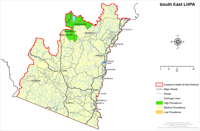
South East LHPA - OJD Prevalence Areas
View large version of map (1.2Mb PDF)
High Prevalence Area (HPA)
That part of the South East LHP lying east of the Queanbeyan River from the junction of the Queanbeyan River and ACT border to the junction of Urila Creek then along Urila Creek to Tinderry Crossing then north along Woolcara Lane to Spring Creek Firetrail to Beverley Hills Fire Trail eastward to Beverley Hills Rd to Captains Flat Rd. Then south-east along Captains Flat Rd to Harolds Cross Rd then north-east until Main Range Rd then north to Lowden Rd to Rossi Rd then west to Hoskinstown Rd to Bungendore. From Bungendore the HPA lies to the north of the Kings Highway as far as the Shoalhaven River at Warri, where then is bounded by the Shoalhaven river until it crosses into the Cumberland LHPA.
Medium Prevalence Area (MPA)
The remainder of the LHP district not described above in the HP area.
