Land Management Research
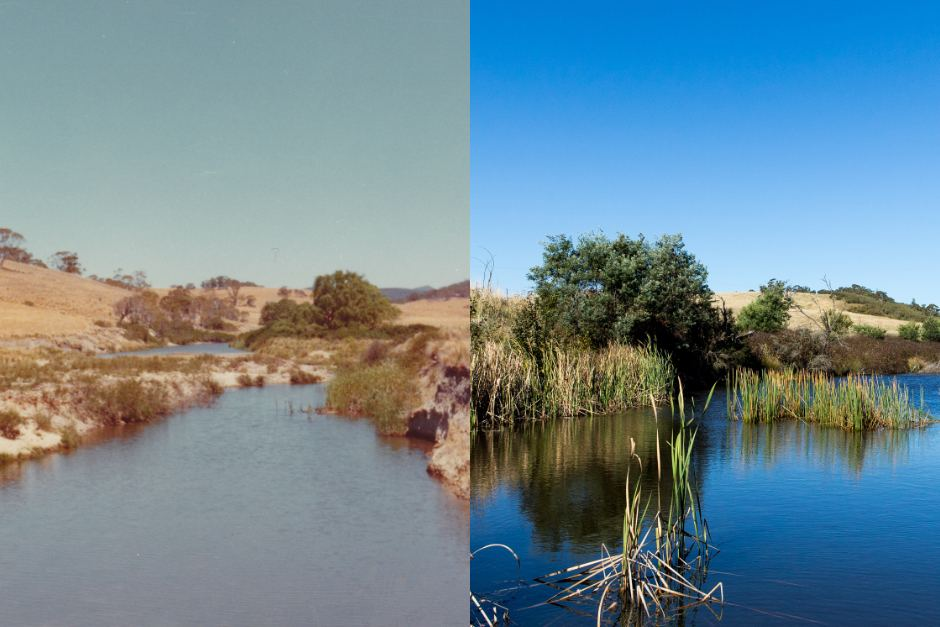
Rehydration and Revegetation in Cobar
Changes in landscape function, ground cover, productivity, biodiversity and water infiltration are being measured using field monitoring and real-time digital sensors on a site trialling deep ripping practices.
NSW Rehydration Priority Mapping
An interactive heat map which classifies NSW agricultural areas on their potential to benefit from the adoption of landscape rehydration practices. Outputs will inform farmers and catchment manages if landscape rehydration is appropriate and maximise probability of successful implementation.