Buffalo fly
Changes in buffalo fly climate suitability are likely to create challenges for the beef and dairy industries.
Buffalo fly in NSW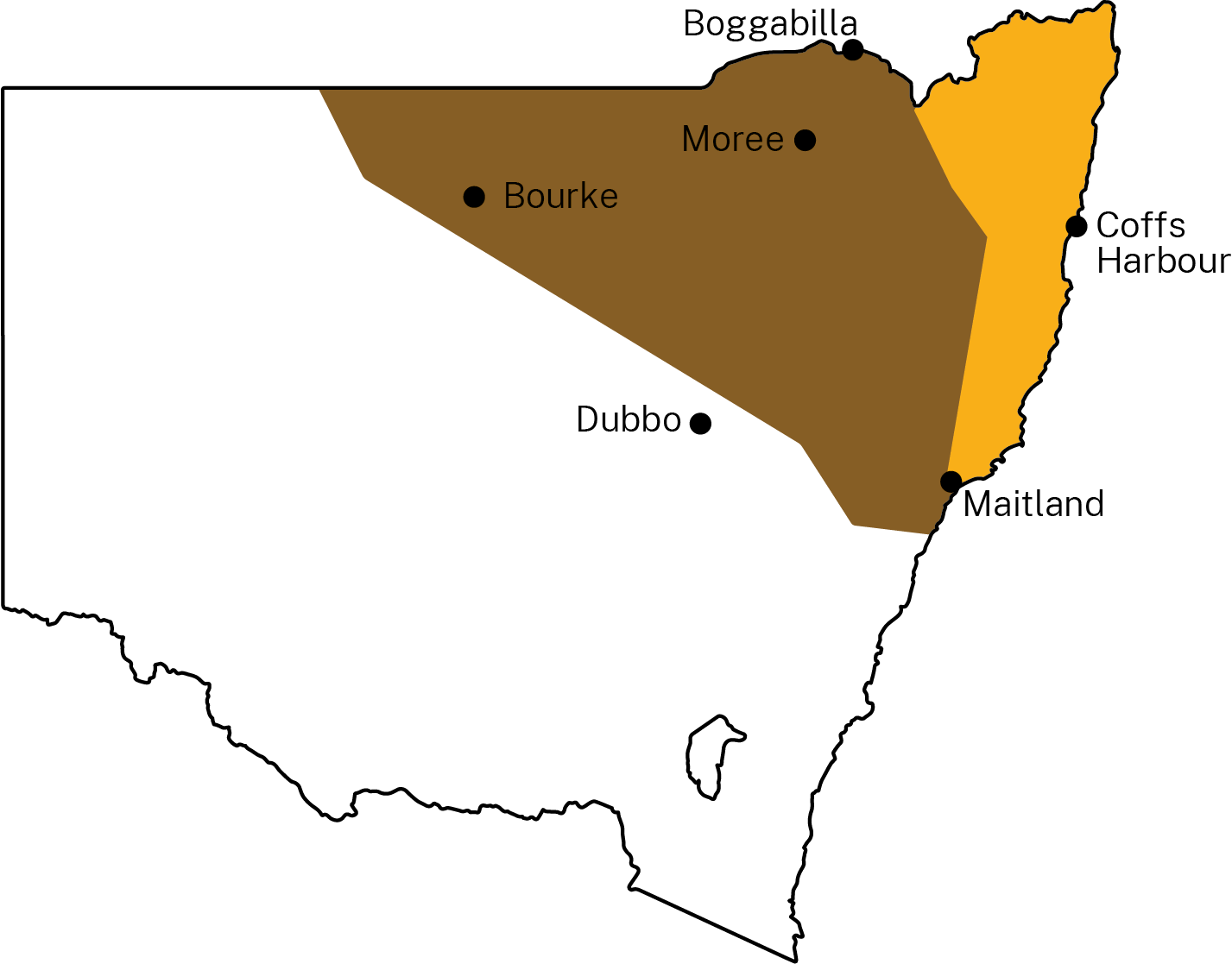
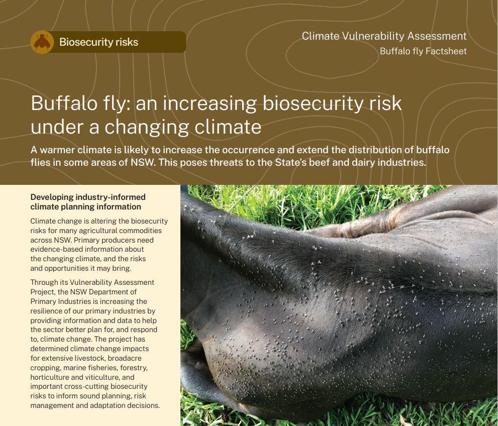
Buffalo fly (Haematobia irritans exigua) is an introduced small livestock parasite that primarily affects cattle and buffalo. It is found mainly in northern Australia, including north-eastern NSW and costs the Australian beef cattle industry an estimated $99 million annually. Adult flies live on cattle, biting them and feeding on their blood up to 40 times a day. This causes irritation, allergies and sores that can reduce the productivity of heavily infested cattle.
Buffalo fly occurs in both endemic and seasonal regions in NSW. The map shows endemic (yellow) and seasonal (brown) distribution of buffalo flies across NSW. Bourke, Dubbo and Maitland represent the edges of the seasonal distribution. In endemic areas, the flies are an ever-present pest, especially from November to April when their numbers increase greatly due to warmer weather.
The key buffalo fly life stages include egg, larvae and pupae, with the adult stage excluded because adult fly survival is dependent on the host, rather than on the climate. Flies overwinter in low numbers in sheltered, moist and hilly areas that are less likely to be affected by frost. The population increases and spreads from endemic regions into seasonal regions during spring and summer. During the wet years of 2010–11, buffalo fly was detected as far south as Maitland and as far west as Bourke.
What is the NSW DPIRD Climate Vulnerability Assessment? ⏷
Climate change is altering the biosecurity risks for many agricultural commodities across NSW. Primary producers need evidence-based information about the changing climate, and the risks and opportunities it may bring.
The NSW DPIRD Climate Vulnerability Assessments are enhancing the resilience of our primary industries by providing information and data to help the sector better plan for, and respond to, climate change. They have assessed climate change impacts for extensive livestock, broadacre and irrigated cropping, marine fisheries, forestry, horticulture and viticulture, and important biosecurity risks associated with these industries to inform sound planning, risk management and adaptation decisions.
How we assessed climate suitability ⏷
Climate projections were sourced from Climate Change in Australia’s ‘Application Ready Data’. This dataset is comprised of projections from an ensemble of 8 global climate models, each presenting a plausible future climate. Low confidence in the projected changes due to differences between the models is noted in the text. Care should be taken when interpreting these results.
The Climate Vulnerability Assessment is intended to highlight potential industry- or regional-level changes. Intermediate and high emissions scenarios were used in the assessments (RCP4.5 and RCP8.5), but these are not the only future scenarios possible. The inclusion of climate variables important to the commodities production was based on published research, expert knowledge and data quality and availability.
Climate suitability was assessed on a monthly timescale, with the reported climate suitability representing the average for a given month over all years in the dataset. This reflects the pattern of life stages for buffalo fly and the need to determine which months are likely to pose the greatest risk to host commodities.
Learn more in the Climate Vulnerability Assessment Project Framework.
Climate impacts: expected challenges for primary industries
Changes in climate suitability are likely across all key life stages of buffalo fly by 2050, under both emission scenarios.
Changes to overall monthly climate suitability affect buffalo fly in NSW in different ways:
- February to May and September to November – there are likely to be minimal to moderate increases in climate suitability in endemic (moderate to high confidence) and seasonal regions (low to high confidence). The increases are likely to be greatest under the high emissions scenario.
- June to August –there are likely to be minimal to moderate increases in climate suitability in the endemic region. The increase is likely to be greatest under the high emissions scenario (moderate to high confidence).
- November to March – there are likely to be minimal to moderate decreases in climate suitability in the seasonal region. The decrease is likely to be greatest under the high emissions scenario (low to high confidence).
The effects of buffalo fly increase in NSW on beef and dairy industries will depend on:
- the future distribution of those industries,
- changes in production timings, and
- the overlap between the vulnerable life stages of cattle and the lifecycle of buffalo fly.
A moderate increase in climate suitability to the south and west of the current endemic and seasonal regions for buffalo fly during the spring months may lead to a new and significant impact on the beef and dairy industries in areas not currently affected.
Some breeds of cattle in the southern regions of Australia, such as Bos taurus, are more susceptible to buffalo fly than other breeds, such as Bos indicus. Production loss for dairy cattle due to buffalo fly is greater than for beef cattle. This is because dairy cattle are high performing production animals and even a modest infestation of 30 flies lowers milk production. Due to cooler temperatures in southern NSW, there are generally fewer buffalo flies than in the north of the state, and so management practices are quite different: southern cattle producers may need education on the increasing risk of buffalo fly and management strategies if a warmer future facilitates a southward spread.
Where can I find the climate suitability maps?
Maps of historical and future climate suitability for commodities and biosecurity risks were produced to demonstrate where in the state they are likely to thrive or else be limited by future climatic conditions. The maps are provided in the Buffalo Fly Results Report (PDF, 5254.46 KB).
Buffalo Fly Factsheet
(PDF, 351.41 KB)
Buffalo Fly Results Report
(PDF, 5254.46 KB)
