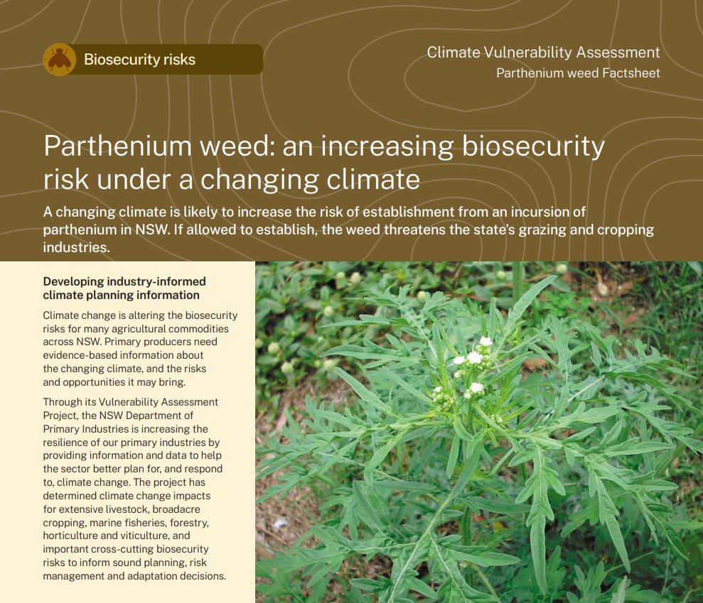
Parthenium weed
Changes in parthenium weed climate suitability are likely to create challenges for grazing systems.
Parthenium weed in NSW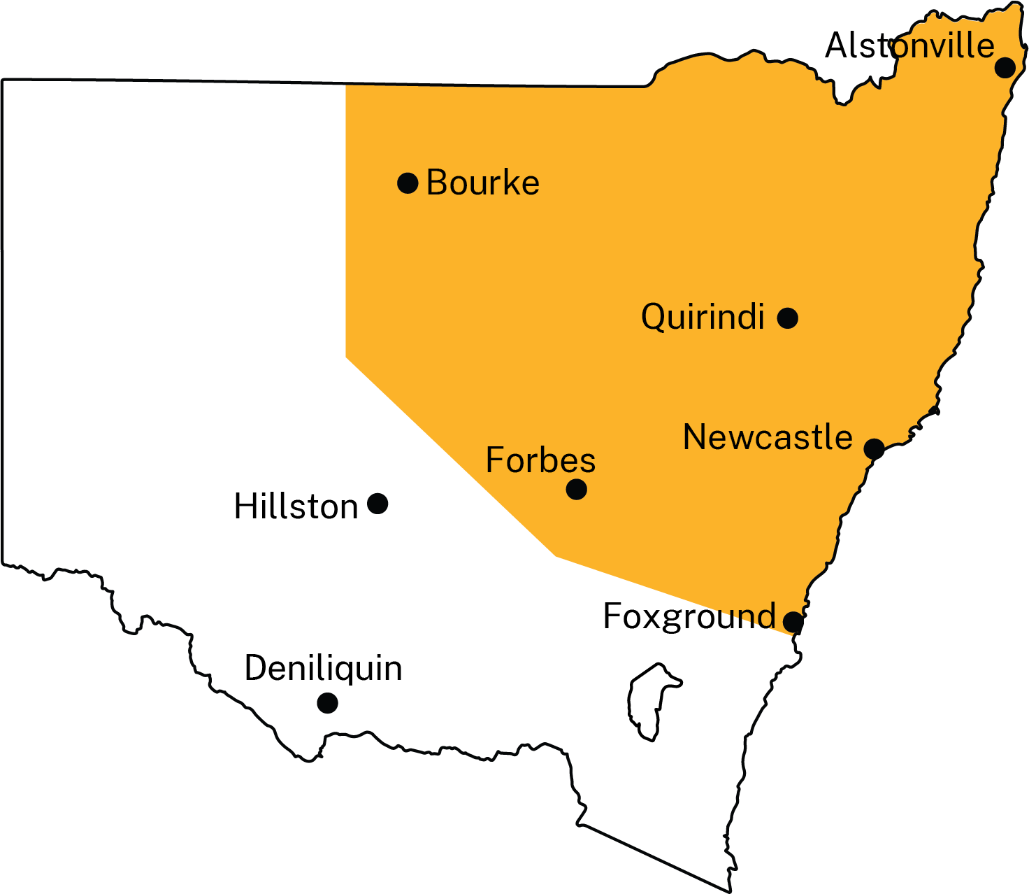
Parthenium weed (Parthenium hysterophorus) is an aggressive annual weed found in high rainfall zone, mixed cropping zone and rangeland pastures, though it is not currently established in NSW. Parthenium weed can also impact vineyards and small cropping areas. As a biosecurity threat, it is classified as ‘prohibited matter’ in NSW, which ‘could have significant adverse consequences to the economy, environment or community’ if established.
Parthenium weed is highly adaptable and thrives in a variety of habitats and climatic conditions. The weed produces many seeds that can remain dormant for a long time and are easily spread by machinery and vehicles, as well as in mud, water, and wind, and through contaminated seed and grain. It impacts the establishment, production and yield of pastures and crops, and is toxic to grazing animals. Parthenium weed can also cause dermatitis, hay fever and respiratory problems in humans.
The weed’s growth is restricted to the warmer and wetter conditions occurring from spring to autumn. Although frequent incursions from Queensland continue to occur, the weed has yet to establish a long-term population in NSW. Parthenium weed has mainly been found in north eastern NSW, as indicated on the map (yellow region). Locations indicate known incursion sites. The key parthenium weed life stages include seedling, vegetative growth and reproductive growth.
What is the NSW DPIRD Climate Vulnerability Assessment? ⏷
Climate change is altering the biosecurity risks for many agricultural commodities across NSW. Primary producers need evidence-based information about the changing climate, and the risks and opportunities it may bring.
The NSW DPIRD Climate Vulnerability Assessments are enhancing the resilience of our primary industries by providing information and data to help the sector better plan for, and respond to, climate change. They have assessed climate change impacts for extensive livestock, broadacre and irrigated cropping, marine fisheries, forestry, horticulture and viticulture, and important biosecurity risks associated with these industries to inform sound planning, risk management and adaptation decisions.
How we assessed climate suitability ⏷
Climate projections were sourced from Climate Change in Australia’s ‘Application Ready Data’. This dataset is comprised of projections from an ensemble of 8 global climate models, each presenting a plausible future climate. Low confidence in the projected changes due to differences between the models is noted in the text. Care should be taken when interpreting these results.
The Climate Vulnerability Assessment is intended to highlight potential industry- or regional-level changes. Intermediate and high emissions scenarios were used in the assessments (RCP4.5 and RCP8.5), but these are not the only future scenarios possible. The inclusion of climate variables important to the commodities production was based on published research, expert knowledge and data quality and availability.
Climate suitability was assessed on a monthly timescale, with the reported climate suitability representing the average for a given month over all years in the dataset. This reflects the pattern of life stages for parthenium weed and the need to determine which months are likely to pose the greatest risk to cropping and grazing systems.
Learn more in the Climate Vulnerability Assessment Project Framework.
Climate impacts: expected challenges for primary industries
Changes in climate suitability are likely across all key life stages of parthenium weed by 2050, under both emission scenarios.
Changes to overall monthly climate suitability affect parthenium weed in NSW in different ways:
- April to October – there are likely to be minimal to moderate increases in climate suitability in the parthenium incursion region. The increase is likely to be greatest under the high emissions scenario (moderate to high confidence).
- November to March – there are likely to be minimal to moderate decreases in climate suitability in the parthenium incursion region. The decrease is likely to be greatest under the high emissions scenario (low to high confidence).
The effects of parthenium weed incursions in NSW on grazing systems will depend on:
- the future distribution of the affected grazing systems,
- changes in production timings, and
- the overlap between production phases and the lifecycle of parthenium weed.
Increased climate suitability along the Great Dividing Range from the Queensland border to southern NSW during August could heighten future risk of parthenium weed establishment due to proximity to Queensland, where the weed is present, and the presence of vectors to distribute the seeds after seed set in the summer months. The probable changes to climate suitability due to increased winter mean temperatures and decreased incidences of frost may become of concern for future incursions in the following regions: in southern NSW regions and areas close to the Victorian border, such as along the Murray River.
Current strategies to manage the weed are likely to remain effective but approaches to surveillance may need to be modified in response to changes in climate suitability. Current strategies do not account for the various dispersal mechanisms for parthenium seeds, the increased climate suitability creating positive conditions for an incursion across the Queensland border and expected increases in climate suitability along the Great Dividing Range. Expanded surveillance coverage to ensure early detection and response to new incursions in these regions may be needed. An incursion beyond the current parthenium region may necessitate education programs to aid with earlier identification of the weed and local eradication.
Where can I find the climate suitability maps?
Maps of historical and future climate suitability for commodities were produced to demonstrate where in the state a commodity is likely to thrive or else be limited by future climatic conditions. The maps are not provided on these webpages but can be found in the Climate Vulnerability Assessment Summary Report (PDF, 41425.92 KB).
Parthenium weed Factsheet
(PDF, 356.78 KB)
Summary Report
(PDF, 41425.92 KB)