Precision Agriculture
Enhancing Precision Agriculture
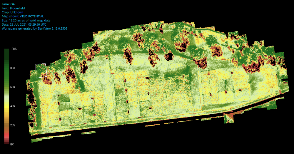
Precision agriculture utilises a range of information technologies to identify variations in farm landscapes and manage the different areas to maximise output. Typical implementation of precision agriculture relies on classing areas of farm properties into large ‘production zones’. However, these zones are often too broad to fully capitalise on converting available information into productivity benefits.
Combining commercial technologies, farm records, DPI crop, soil and water models to develop a proof-of-concept geospatial farm management tool. The tool will provide daily estimates of plant available water (PAW), soil nutrient requirements, climate predictions and yield estimates on a 10m grid.
This tool will provide value through specifying the recommended guidelines of necessary input to reach the 10m grid i.e. number of soil samples, hardware density and software requirements. Additionally, the findings will feed into training and education programs by Tocal College on precision agriculture.