Farm Water Monitoring in NSW
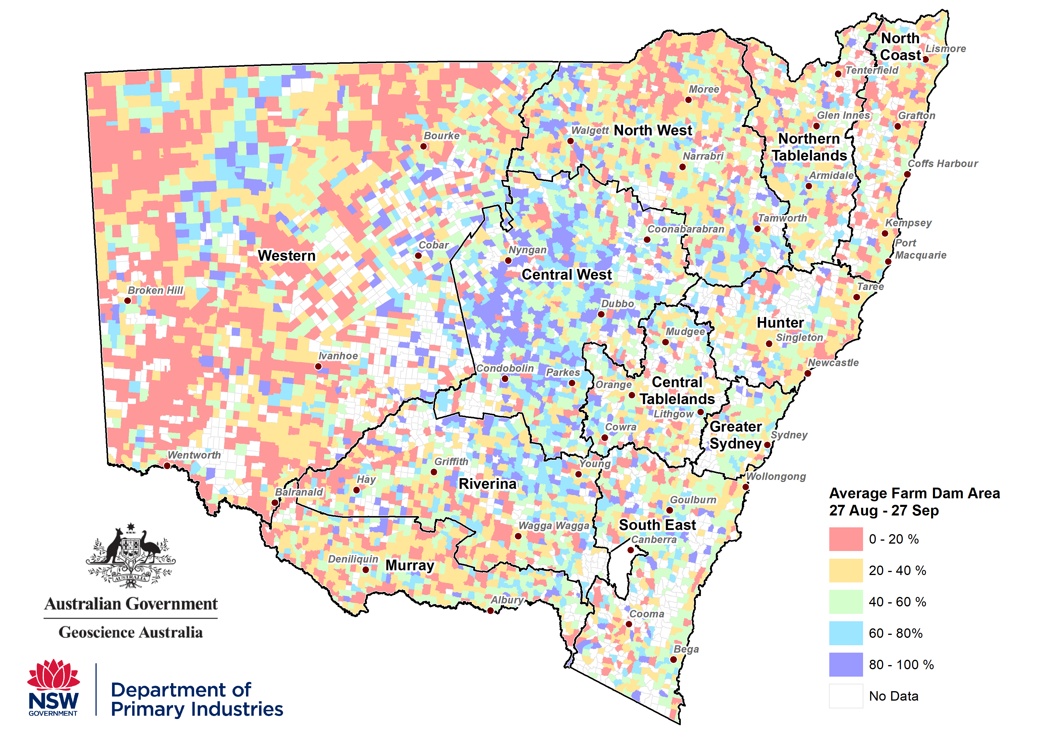
The Farm Dam Water assessment is the first ever widespread audit of farm dam conditions in NSW. Through a collaboration between DPI and Geoscience Australia’s Digital Earth Australia Program (DEA), the project maps water surface area of farm dams using high resolution remote sensing technology.
The DEA Waterbodies product uses the USGS satellite Landsat to detect all water bodies in the size range of 3125 m2 – 10 km2. The Landsat remote sensing data is then used to compare the current water surface area in each water body to the maximum extents on record between the year 1987 and present. Large storages that are potentially part of irrigation schemes or river reaches are excluded from the analysis.
Approximately 47,000 individual waters bodies are monitored across NSW, which are then aggregated to the parish level and reported monthly in the NSW State Seasonal Update.