April 2024
 Northern Tablelands Local Land Services
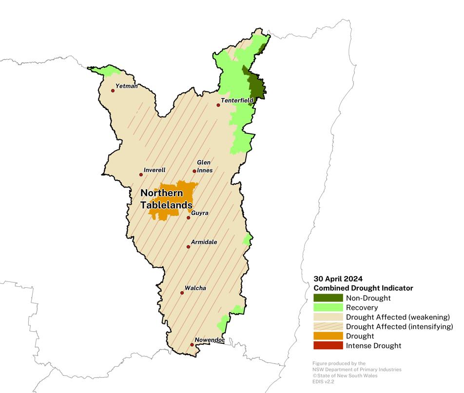
Drought conditions ease for much of the region.
- The Combined Drought Indicator (CDI) shows approximately 85% of the region being in a drought category at the end of April.
- This is predominantly the ‘Drought Affected’ category, indicating a reduced intensity in the dry conditions that have been experienced across the region.
- Above average rainfall during April has seen improvement in drought conditions across much of the region. However, rainfall totals have been highly variable, leading to differing rates of recovery.
- Longer term rainfall deficits (since the beginning of 2024) remain for some regions.
- While some locations are experiencing significant improvement, others are seeing slower responses, with indicators remaining low.
- Pasture management and storing fodder reserves will remain a focus for many producers for the remainder of autumn.
- Further rainfall is needed to ensure longer term improvement in conditions.
- The NSW DPI continues to closely monitor conditions in these regions.
Click on the scroll bar below the map to compare with previous months.
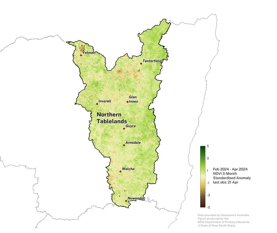
Normalised Difference Vegetation Index
Widespread variability remains within the region but has remain generally stable since the previous Update.
- Some of the extremely negative NDVI areas (brown patches) are water bodies.
Click on the scroll bar below the map to compare with previous months.
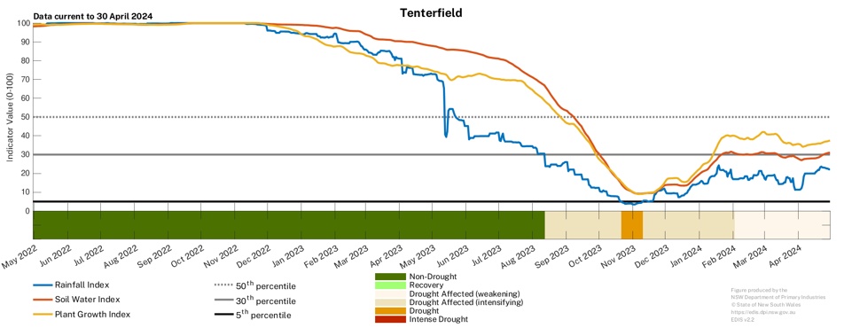
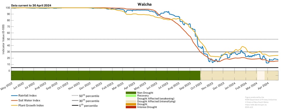
Individual Drought Indicators
Drought indicators remain steadyacross the region.
- The drought indicators responded to early April rainfall, however continued rainfall to ensure the indicators continue to improve.
- To access a Drought History chart for your Parish, visit the Seasonal Conditions Information Portal.
