

Rangelands
") The arid and semi-arid areas of New South Wales are commonly referred to as 'rangelands'. These lands generally lie to the west of the 500 mm average rainfall limit. The main enterprise is extensive grazing of predominantly native pastures. On the eastern and southern margins of the rangelands, extensive grazing occurs in conjunction with broadacre cropping and areas of intensive irrigated agriculture. Collectively, the semi-arid and arid zones occupy about 60 per cent of the State.
The arid and semi-arid areas of New South Wales are commonly referred to as 'rangelands'. These lands generally lie to the west of the 500 mm average rainfall limit. The main enterprise is extensive grazing of predominantly native pastures. On the eastern and southern margins of the rangelands, extensive grazing occurs in conjunction with broadacre cropping and areas of intensive irrigated agriculture. Collectively, the semi-arid and arid zones occupy about 60 per cent of the State.
The department has research and technical staff located at Trangie Agricultural Research Centre with expertise in rangeland ecology and management, grazing systems, sustainable agriculture, pasture production and climate variability and change.
Over the years the department has developed a number of resources to assist graziers with the management of rangeland areas.
 Grazing management
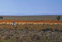
Grazing management of rangeland areas is important to ensure sustainable utilisation of these areas by extensive grazing industries. Total grazing pressure (TGP) is the total pasture demand of both managed livestock and unmanaged herbivores relative to the pasture supply.
- The glove box guide to tactical grazing management for the semi-arid woodlands
- Best management practices for extensive grazing enterprises
- Restoration of degraded grazing country in the semi-arid areas of NSW
- Addressing feed supply and demand through total grazing pressure management
- Social acceptability of pest animal management in meeting TGP targets
 Native grasses
Native grasses are those that occurred naturally in Australia at the time of European settlement and many species are valuable to extensive grazing systems.
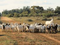 Goats
Goats
Goats were once considered a pest animal in the rangelands. Now they are a valuable income source for graziers and are often managed alongside other livestock.
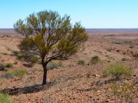
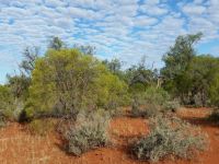 Invasive native scrub
Invasive native scrub (INS) refers to the encroachment or increasing density of native shrub or tree species into previously open areas, which can compete with pastures and reduce productivity and function of landscapes. An integrated and ongoing management approach is required. Management burns are one method of invasive native scrub control.
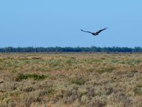
 Seasonal conditions
Better understanding weather patterns can assist graziers to plan and make informed decisions as the season progresses.
