

Agriculture industry snapshots for planning
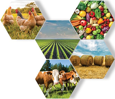
Agricultural industry snapshots are summary statements of the main agricultural industries in all regions across NSW. They enable an understanding of agriculture at a regional or sub-regional level and provide information to enable a deeper understanding of agricultural industries.
The information provides evidence for strategic planning to enable agricultural land and agriculturally based economies to be recognised, protected and supported by the NSW planning framework. Nineteen snapshots have been developed across the ten Planning Regions in the State. Some regions have more than one snapshot to reflect the diversity of agriculture and farming operations that occur in different parts of a region.
Recognition of agricultural industries as a significant contributor economically, environmentally and culturally is the precursor to applying best practice land use planning to enable industry investment and growth.
Download the summary
The below table outlines the cluster of local government areas (LGA) for each sub region snapshot within the planning regions. Click on the sub region to download it’s snapshot.
Your feedback
Snapshots will be reviewed once new industry and regional information is available. To provide feedback on the current Snapshots and what you would like to see in future versions please visit our Survey Monkey page.
Planning Region | Snapshot Sub Region | LGA |
|---|---|---|
Central Coast | Central Coast | |
Central West/Orana | Bathurst Regional, Blayney, Cabonne, Cowra, Lithgow, Mid-Western Regional, Oberon, Orange | |
Bogan, Coonamble, Forbes, Gilgandra, Lachlan, Narromine, Parkes, Warren, Warrumbungle Shire, Weddin, Western Plains Regional | ||
Far West | Balranald, Wentworth | |
Bourke, Brewarrina, Cobar, Walgett | ||
Broken Hill, Central Darling, Unincorporated NSW | ||
Greater Sydney | ||
Hunter | Upper Hunter* | Cessnock, Muswellbrook, Singleton, Upper Hunter Shire |
Mid Coast* | Dungog, Mid-Coast | |
Lower Hunter* | Lake Macquarie, Maitland, Newcastle, Port Stephens | |
Illawarra/Shoalhaven | Kiama, Shellharbour, Shoalhaven, Wollongong | |
New England/North West | Gunnedah, Liverpool Plains, Moree Plains, Narrabri | |
Armidale Regional, Glen Innes Severn, Gwydir, Inverell, Tamworth Regional, Tenterfield, Uralla, Walcha | ||
North Coast | Ballina, Byron, Clarence Valley, Kyogle, Lismore, Richmond Valley, Tweed | |
Bellingen, Coffs Harbour, Kempsey, Nambucca, Port Macquarie-Hastings | ||
Riverina Murray | Albury, Berrigan, Edward River, Federation, Greater Hume Shire, Murray River | |
Bland, Carrathool, Griffith, Hay, Leeton, Murrumbidgee, Narrandera | ||
Coolamon, Cootamundra- Gundagai, Junee, Lockhart, Snowy Valleys, Temora, Wagga Wagga | ||
South East and Tablelands | Goulburn Mulwaree, Hilltops, Queanbeyan-Palerang Regional, Snowy Monaro Regional, Upper Lachlan Shire, Wingecarribee, Yass Valley, Bega Valley, Eurobodalla |
* Snapshots to be completed by March 2021.
