

Development Assessment
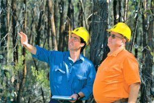


The department's role in development is to support informed decision‑making by advising consent authorities (usually local councils) on the agricultural impacts of development proposals. The department also provides advice on features that support sustainable agricultural development. In the end, the decision to allow or refuse development falls to the council or Department of Planning and Environment (DPE).
When advising consent authorities on the agricultural impacts of a proposal, the department might consider
- the rules established by the planning system for the locality
- the impact on the long-term sustainability of agriculture in the locality
- the potential for conflict between residential and farming neighbours
- the impact on land and water resources used for agriculture
To help consent authorities identify important agricultural issues, the department has produced a range of assessment guidelines for development that affects rural lands, such as rural subdivision. The department also provides advice on specific Intensive Agricultural development proposals in response to requests from local councils or DPE.

Local Environmental Plans
Local Environmental Plans (LEPs) guide a council’s planning decisions for their local government areas. LEPs are the main planning tool used to shape the future of communities and ensure local development is carried out appropriately. LEPs that provide due regard for agricultural land use can prevent the emergence of land use conflict in a local government area.
The mechanisms an LEP uses to control land use on rural land include
- land use zones to allocate land in certain areas for certain purposes (zoning of your land can be found at the ePlanning Spatial Viewer)
- land use tables which specify which land uses are permissible or prohibited in a zone
- minimum Lot Size controls to limit subdivision of land
- specific planning controls to specify how certain developments are to proceed
To ensure that all plans retain opportunities for agriculture to grow, Agricultural Land Use Planning (ALUP) provides advice to councils and other authorities about provisions to minimise fragmentation and risk of land use conflict.
An LEP may achieve this by creating
- a stable environment for investment that avoids conflict between residential and agricultural neighbours
- flexibility in the range of production systems that can be used, for example the opportunity to use best practice with minimum regulatory interference
- opportunities to produce a range of commodities
- a critical mass (or cluster) of agricultural development that supports regional markets, processing facilities, and related industries (e.g. equipment retailers)

Managing biosecurity risks in land use planning and development guide
The Managing Biosecurity Risks in Land Use Planning and Development Guide (the Guide) outlines steps to be considered to ensure biosecurity is appropriately addressed during the planning and assessment of development proposals. The Guide may be particularly helpful for guiding agricultural enterprises who seek to submit activities or proposals that may impact on agricultural enterprises or industries.
The Guide seeks to help development proponents, development assessment authorities, and other stakeholders to understand the relevance of biosecurity risk management in land use planning and development. Specifically, its importance in mitigating potential impacts of a development proposal on the environment, economy, and community.
Learn more about land use planners and developers and biosecurity.

