

Important Agricultural Land Mapping in NSW - FAQs
Purpose
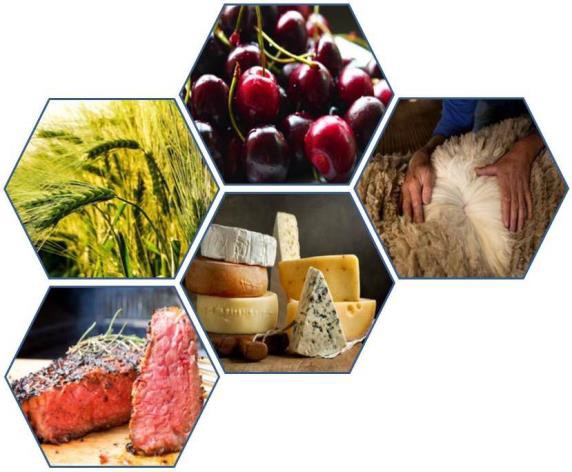
The NSW Department of Primary Industries is undertaking a mapping program across NSW to assist state and local government, other organisations and industries to recognise and value important agricultural land. The program supports the NSW Department of Planning and Environment’s regional planning targets that include actions to map important agricultural lands in NSW.
Frequently Asked Questions
Why map Important Agricultural Land?
.")
Knowing where the States most important agricultural land is situated and understanding its value and contribution to regional economies will assist in making planning decisions about agricultural land. This information will help government and industry to:
- provide more certainty for agribusiness to remain, invest and grow
- reduce land use conflict
- enable compatible development in zones that permit agriculture
- choose appropriate zones for non-agricultural development
- support essential agricultural assets and the agricultural supply chain
- identify future opportunities for agricultural industries
Loss of access to agricultural resources and increased incidences of agricultural land use conflict has the potential to create inefficient land use shifts. This can result in a net loss of value to the State through:
- direct and indirect economic loss of produce and markets;
- loss of primary industries, associated businesses and services and related employment;
- social decline and loss of community connectivity.
What will the updated project produce?
The updated project will develop a map that identifies the best agricultural land on a statewide basis. It is intended this land will be incorporated into the NSW planning framework. This map is derived from existing state wide information where the most relevant characteristics related to the best lands are used.
Profiles will be developed identifying key industries in the State’s regions and discuss opportunities and constraints to their agricultural growth primarily from a planning perspective. Information gathered from agricultural industry leaders at State and Regional level will inform these profiles.
Where will the updated project cover?
A map will be prepared identify the most important agricultural land across the State. Agricultural profiles will be developed at a regional scale. Some regions will have sub regional information depending on the key industries identified, the geographical/climatic characteristics and agricultural resources of the regions and their challenges and opportunities.
How does Important Agricultural Land Mapping relate to other mapping such as BSAL?
In NSW various sources of information are used to identify agricultural industries and their dependent resources for land use planning purposes. The intent of the Important Agricultural Land Mapping Project is to identify land which has the inherent capability of being productive with minimal inputs. This process will identify more land than that identified in the BSAL mapping process.
Further information on the types of mapping sources used for land use planning go to The Agricultural Land Use Mapping Resources in NSW - User's guide.
What tools will be available when the updated project is finished?
The Important Agricultural Land Mapping will be available in several formats. Spatial data will be available through a public portal for use in GIS. The reports and profiles will be in pdf format available on the DPI Agriculture website.
Further information
For further information on the updated project please email landuse.ag@dpi.nsw.gov.au and a delegate we will respond to your enquiry.

