Estuarine - artificial reefs
Estuarine artificial reef locations
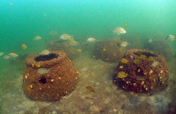
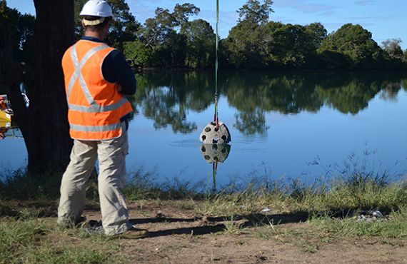
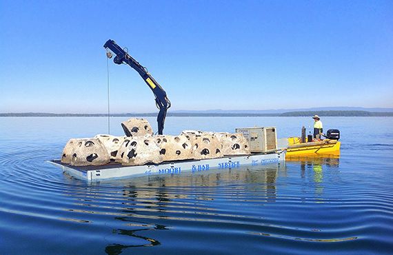
The NSW DPIRD has deployed six artificial reef locations across the states estuaries, which are listed below. Estuarine artificial reefs (EAR’s) are mainly comprised of hollow concrete spheres known as “Reef Balls”, which provide new locations for fishing and more habitat for fish, algae and crustaceans.
Note: All coordinates are in WGS84 datum and represent the approximate centre point of each reef site
Reef Location | Latitude (S) | Longitude (E) | Approx. No. of Reef Balls | Depth (m) |
|---|---|---|---|---|
Lake Macquarie | 33° 05.814' | 151° 36.891' | 520 | 5 |
Botany Bay | 33°.58.940' | 151°.13.447' | 400 | 6-15 |
Bellinger River (1) | 30° 27. 569' | 153°.02.360' | 50 | 3 |
Bellinger River (2) | 30°.26.404' | 153°.01.110' | 50 | 3 |
Bellinger River (3) | 30°.26.525' | 153°.00.786' | 50 | 3 |
St Georges Basin (1) | 35° 07.449' | 150° 37.031' | 300 | 4-6 |
St Georges Basin (2) | 35° 07.259' | 150° 37.928' | 300 | 4-6 |
Lake Conjola | 35° 15.628' | 150° 28.330' | 400 | 4-8 |
Merimbula Lake | 36° 53.918' | 149° 53.175' | 400 | 5 |