

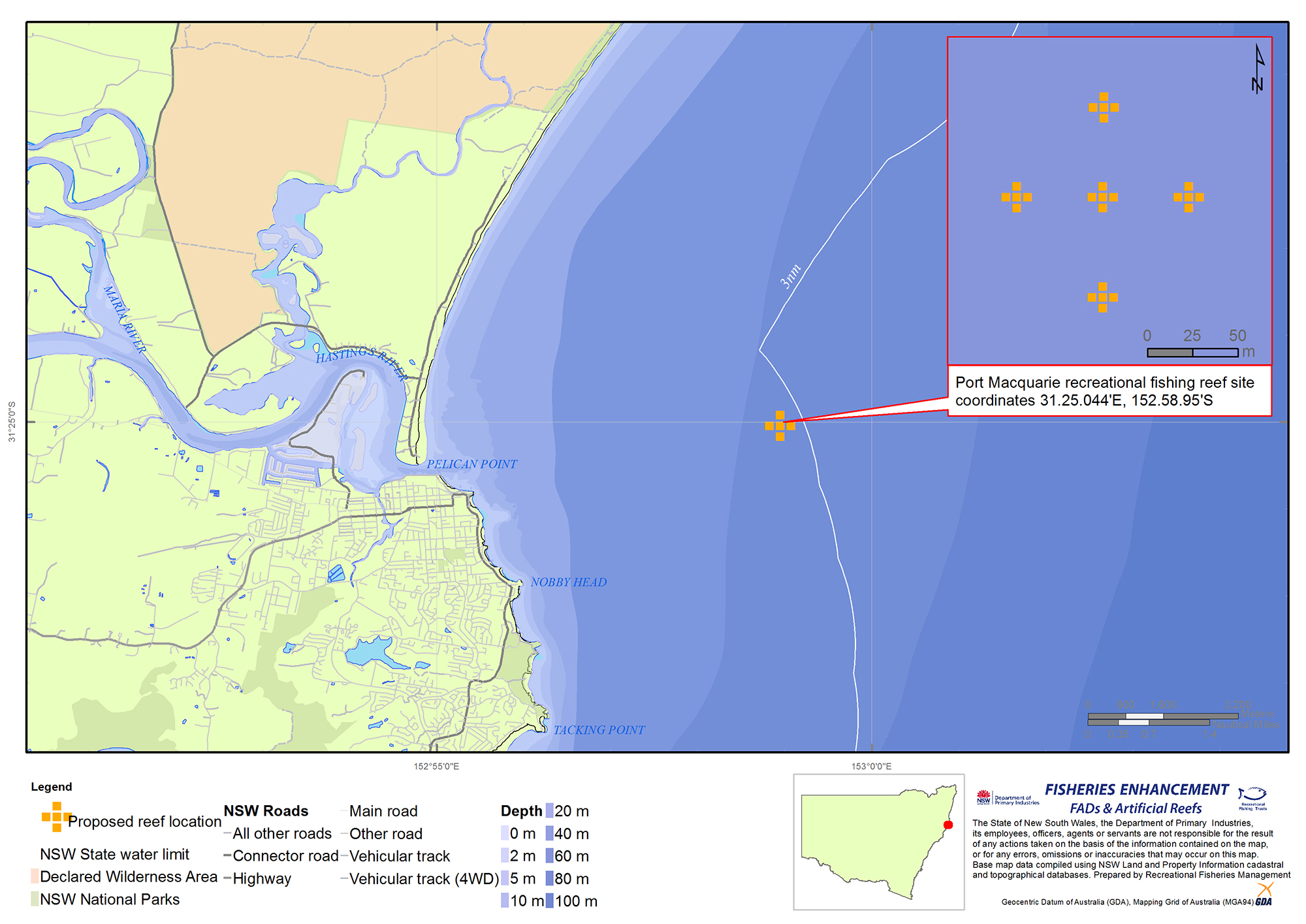
Port Macquarie Offshore Artificial Reef
| Location: | Approx. 6.3km north-east of the Port Macquarie river entrance |
|---|---|
| Depth: | 46 metres |
| Deployment: | February 2016 |
| Coordinates: | 31°25.044' S (Latitude), 152°58.950'E (Longitude) (WGS84 datum) |
| Reef type: | 20 concrete modules deployed in random clusters. Each module is 6.5 metres high and 5 modules have additional steel towers increasing their height to 9 metres |
| Reef area: | Total reef volume is 1,600 cubic metres |
| Species: | Kingfish, Samson fish, Amberjack, Trevallies, Pearl perch, Bar Cod, Snapper Mulloway & Morwongs |
| Other: | The Port Macquarie OAR is exposed to the East Australian Current (EAC) and at times experiences strong currents |
| How to fish: | Conditions such as depth, current and wind all play a part in testing an angler’s patience and skills fishing these locations. Drifting with baits or lures along the edges of reef modules can reduce the risk being “snagged” or fouling an anchor on the vertical towers. For further information please visit our user guidelines - offshore artificial reefs. |
- Download a high resolution version of the Port Macquarie offshore artificial reef map (JPG, 1185.85 KB)
Videos
Outputs
| Title | Details |
|---|
If you require any further information, please call 0457 664 062 or email: fisheries.enhancement@dpi.nsw.gov.au.
