

OJD Prevalence Areas 2011-30 Dec 2012
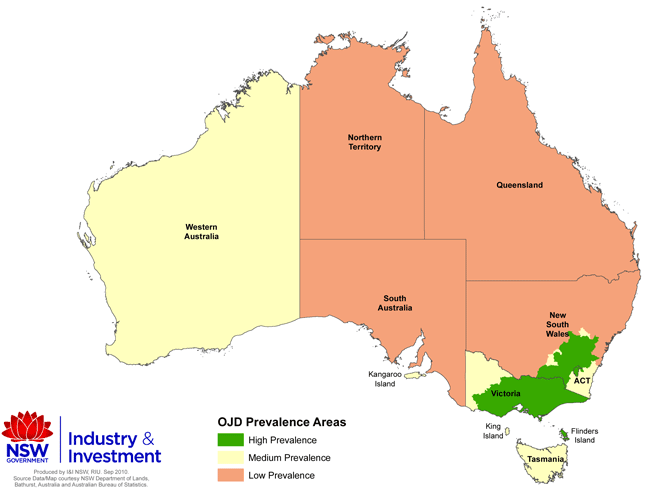
On 1 January 2011 there will be changes to Ovine Johne's disease Prevalence Areas in Western Australia, Victoria and some regions of NSW.
The changes are the consequence of an increasing prevalence of OJD over the past two years in some regions, which has pushed these areas above their allocated prevalence area cut-off under the OJD Management Plan 2007–2012.
Prevalence areas are defined geographical areas that are determined by national Animal Health Committee on the basis of known and estimated level of disease.
The known or estimated level of disease refers to the proportion of sheep flocks in an area that are known or estimated to be infected. This is normally determined by surveillance using both field investigation and inspection at abattoirs.
Summary of changes to prevalence areas
- New South Wales: Changes to boundaries of the Low, Medium and High Prevalence Areas.
- Victoria: The Medium Prevalence Area will become a High Prevalence Area, and the Low Prevalence Area will become a Medium Prevalence Area.
- Western Australia: The Low Prevalence Area will become a Medium Prevalence Area.
There will be no changes to prevalence areas in Queensland, South Australia or Tasmania.
A range of Prevalence Area descriptions and maps are available below.
Prevalence Areas in Australia from 1 Jan. 2011
Download larger version of map (519kb PDF)
This table summarises the revised prevalence areas and their ABC (Assurance Based Credits) points:
|
Revised Prevalence Area from 1 January 2011 |
Maximum estimated % of infected flocks within the Prevalence Area |
ABC points allocated under Category A on the Sheep Health Statement |
|---|---|---|
| High | >12.5% | 0 |
| Medium | 12.5% | 2 |
| Low | 0.8% | 4 |
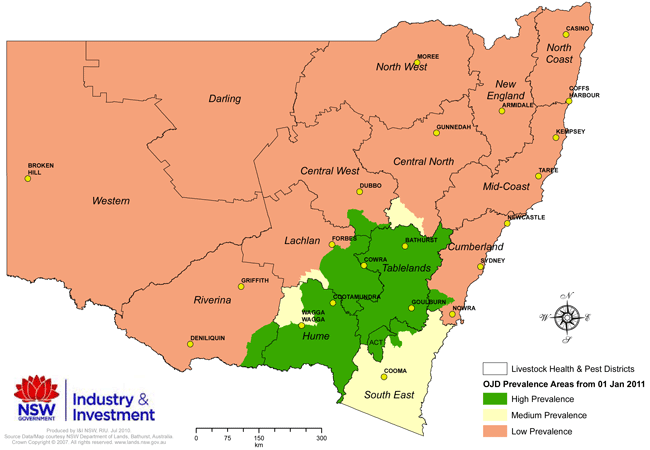
Prevalence Areas in NSW from 1 Jan. 2011
Download larger version of map (349kb PDF)
NSW OJD Exclusion Area map
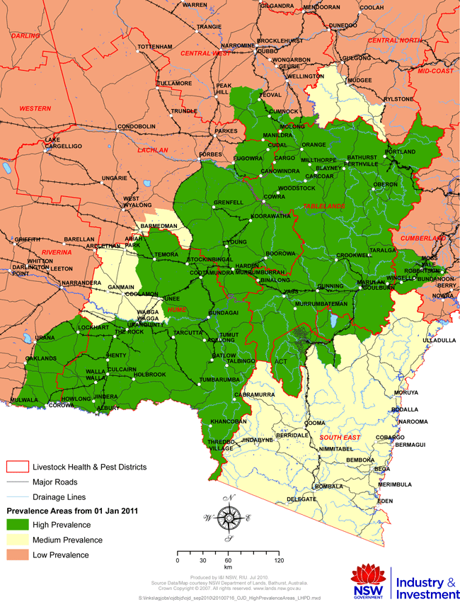
High and Medium Prevalence Area boundaries in NSW from 1 Jan 2011
Download larger version of map (1.1Mb PDF)
OJD Prevalence Areas in NSW by Livestock Health and Pest District
1. Livestock Health and Pest (LHP) Districts comprising the NSW OJD Prevalence Areas
|
Prevalence Area from 1 January 2011 |
LHP Districts |
|---|---|
| High Prevalence (HP) Area | Central West (part), Cumberland (part), Hume (part), Lachlan (part), Riverina (part), South East (part), Tablelands. |
| Medium Prevalence (MP) Area | Central North (part), Hume (part), Lachlan (part), South East (part). |
| Low Prevalence (LP) Area | Central North (part), Central West (part), Cumberland (part), Darling, Lachlan, (part), Mid Coast, New England, North Coast, North West, Riverina (part), Western. |
