

The Great Swordfish and Striped Marlin Race
Learning more about billfish that visit NSW waters
This research aims to learn more about movement and behaviour of swordfish and striped marlin caught off the NSW coast and their post-release survival. Tagging is being carried out by using experienced anglers to deploy pop-up satellite tags into fish caught in NSW waters.
How does a pop-up satellite tag work?
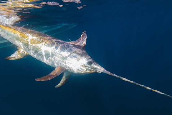
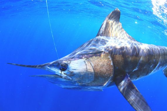
Pop-up satellite archival tags (PSATs) are used to track the movement of marine animals, particularly highly migratory species such as sharks, tuna and billfish. The tags are like mini computers that are externally attached to the fish and travel along with the fish whilst logging information on water depth, light levels and temperature, and gathering information on its location (geolocation). This allows us to gain a greater understanding of the behaviour of the fish, their migratory patterns and catch and release survival. The great benefit of satellite tags is that they do not have to be retrieved to collect the recorded information. After a predetermined time the tag decouples from the fish and ‘pops-off’, floating to the surface. The tag then transmits the data that it has stored whilst it has been underwater to orbiting satellites that pass overhead. This data is then relayed back to DPI. Complex statistical models process the data to estimate the most likely movement track.
The project will provide us with data on the on the timing and availability of swordfish and striped marlin in NSW and their post release survival. The department is undertaking the project with the Australian National Sportfishing Association (NSW) and NSW Game Fishing Association.
The Great Swordfish and Striped Marlin Race
 This project also includes the “Great Swordfish and Striped Marlin Race” which plans to provide an interactive experience to improve our understanding of these exciting billfish species.
Once the first fish has been tagged, the race will be underway for the individual billfish that travels the furthest distance whilst tagged.
We will keep you updated on the Race and the broader project on this page and on the Fisheries Facebook page, including when fish have been successfully tagged. Information on movement of the fish will be provided when the tags pop-off the fish and their movement data is streamed back to us via satellite.
Striped marlin: Al McGlashan
Why we are undertaking the project
It is important that we learn more about recreational billfish fisheries, to enable them to grow and maximise their potential whilst ensuring the sustainability of the fisheries are maintained.
The project will:
- research the availability of key billfish along the NSW coast to provide seasonality information and connectivity with the broader east coast population.
- run the “Great Swordfish and Striped Marlin Race” to engage anglers and the community on this interactive learning experience.
- Improve knowledge on catch and release mortality.
Data collected from tagged fish
Swordfish
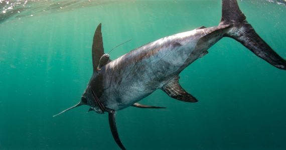
Striped Marlin
