

EOI Map tips
The online map is designed to allow you to do a preliminary assessment of available sites. Visiting sites of interest is strongly recommended to ensure the suitability. The following tips are to help you make the most of the online map:
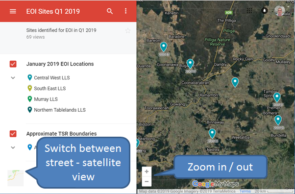
The map provides an overview of available sites across the state. Sites are indicated with pins on the map. Tap or click on the map icon at bottom left to toggle between the satellite view of the map and the street map view. The “+” and “-” icons allow you to zoom in or out of the map. Click and drag your mouse (or slide your finger) across the map to move around.
Viewing in street view helps with navigation. For LLS and Forestry Corporation sites the location pin indicates a potential setdown site. If there is a better location within the boundary this can be agreed with the local LLS or Forestry Corporation officer. Apiaries on lands managed by National Parks must be at the Setdown site at the location indicated by the location pin.
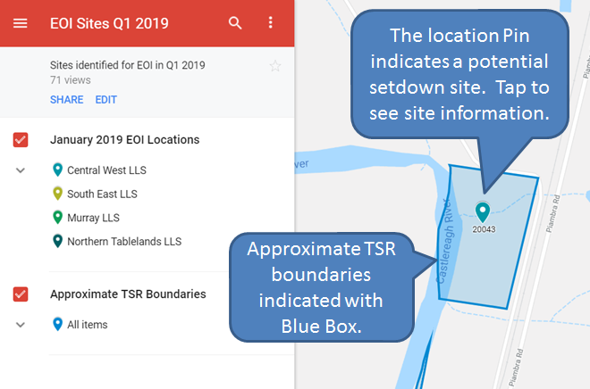
For LLS sites the approximate TSR boundaries are indicated with a Blue transparent box. Note that some TSR’s may contain multiple apiary sites. If placing your apiary site in a location other than the suggested setdown site check with the local LLS officer to ensure you are within the are allocated to your permit.
If you click or tap on the location pin the site information will be displayed in the left hand column.
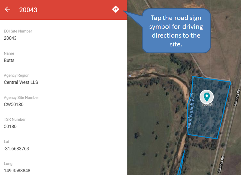
When looking at the site information tap or click on the road sign symbol for driving directions to the site. Information listed about the site includes the EOI Site number (used to identify sites to apply for in the application form), the site name if there is one, the agency region responsible, the internal site number used by the agency, the TSR number, Lat and Long numbers (for external GPS navigation etc.) and directions / location information if available.
