June 2024
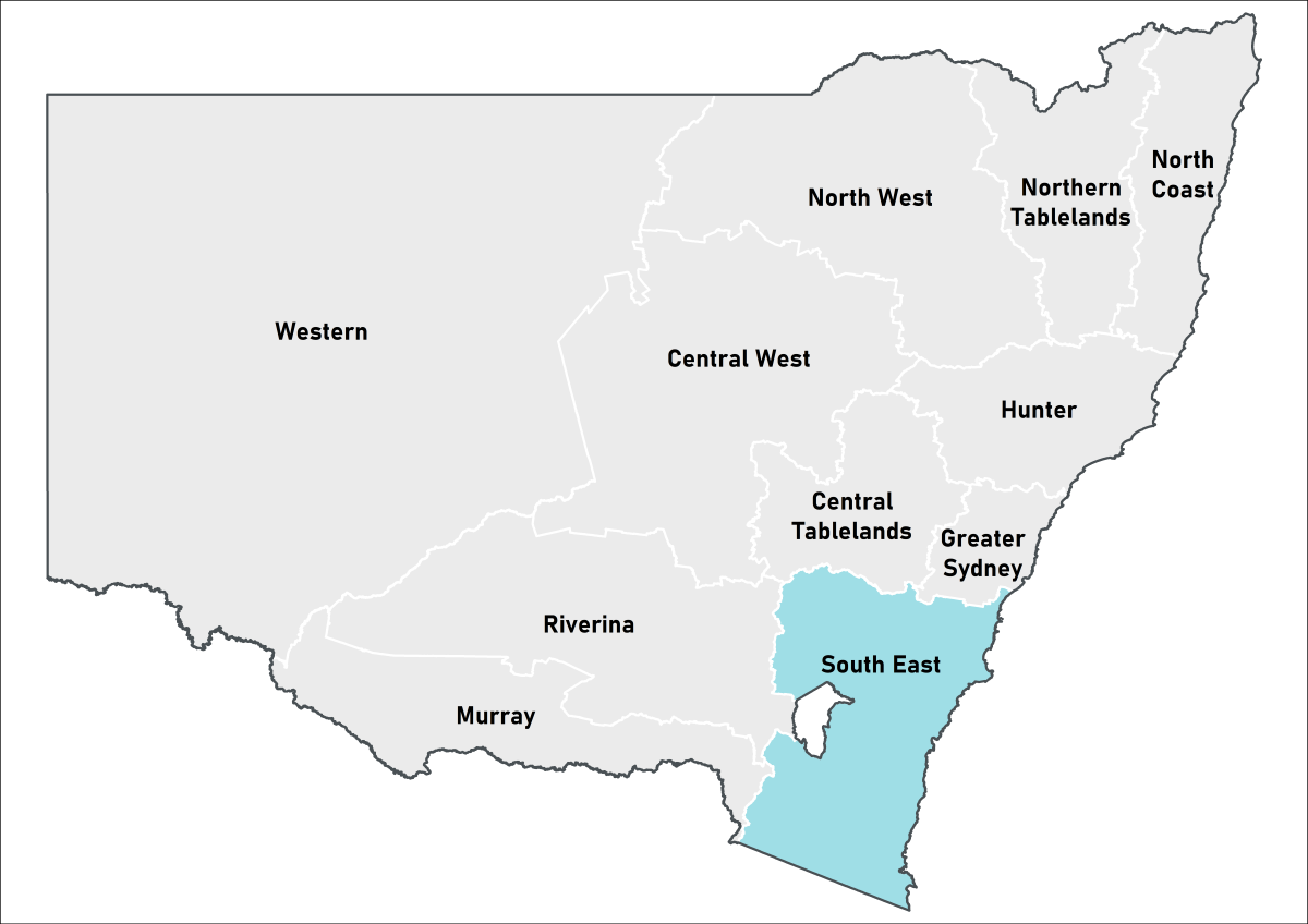 South-East Local Land Services
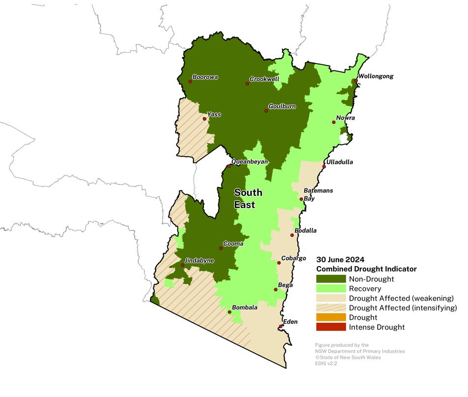
Drought conditions ease for much of the South East region.
- The Combined Drought Indicator (CDI) shows approximately 22% of the region in the one of the drought categories at the end of June.
- June rainfall has been average to above average for the much of the region. The underlying drought indicators are improving for much of the region, with many areas transitioning to the Recovery category.
- Parts of the far south remain in the Drought Affected category, with variable conditions and farm management considerations.
- Producers continue to monitor forecasts closely and implement drought management strategies as required for their enterprises entering winter.
- The DPIRD continues to closely monitor conditions in this region.
Click on the scroll bar below the map to compare with previous months.
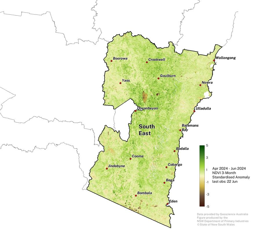
Normalised Difference Vegetation Index
Plant greenness levels are variable across the region.
Click on the scroll bar below the map to compare with previous months. |
Individual Drought Indicators
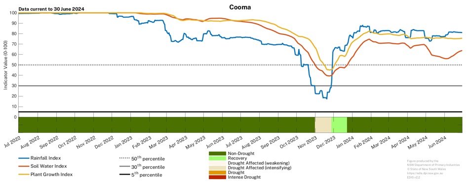
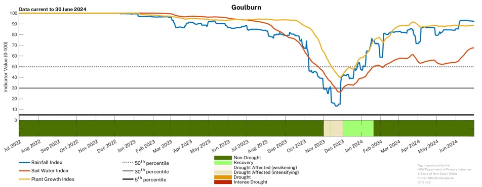
Drought indicators remain highly variable across the region.
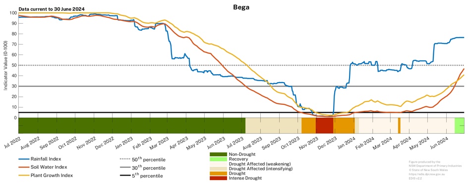
- Rainfall events throughout June has underlined positive trends in individual drought indicators at many locations.
- The rainfall indicator at Bega has seen strong increase over June, driven by recent rainfall events in the region.
- There have been corresponding increases in the plant growth and soil water indicator values, and the region transitioned into the Recovery category during the last week of June.
To access a Drought History chart for your Parish, visit the Seasonal Conditions Information Portal.