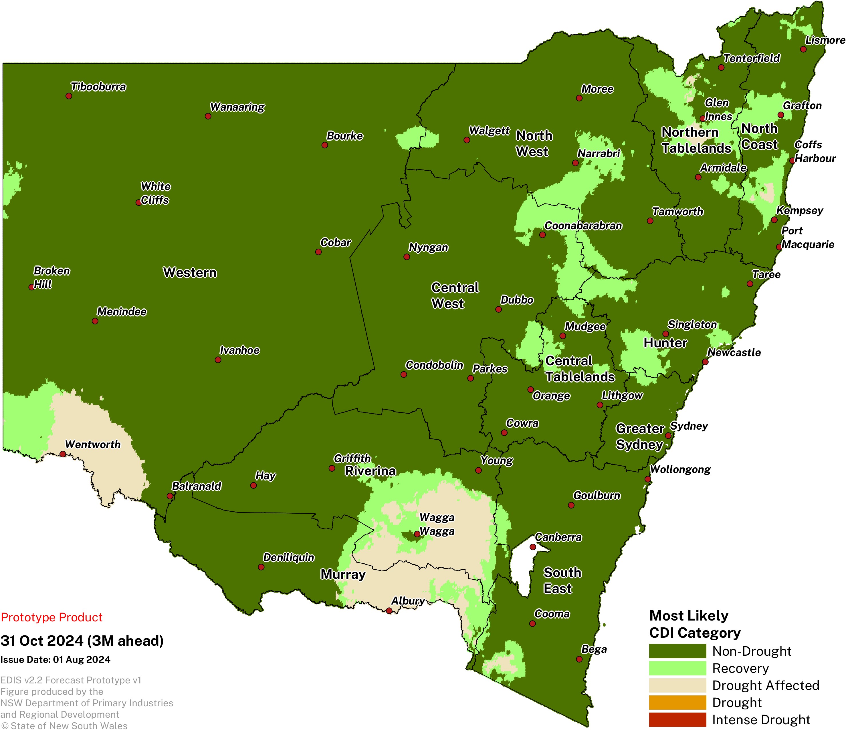
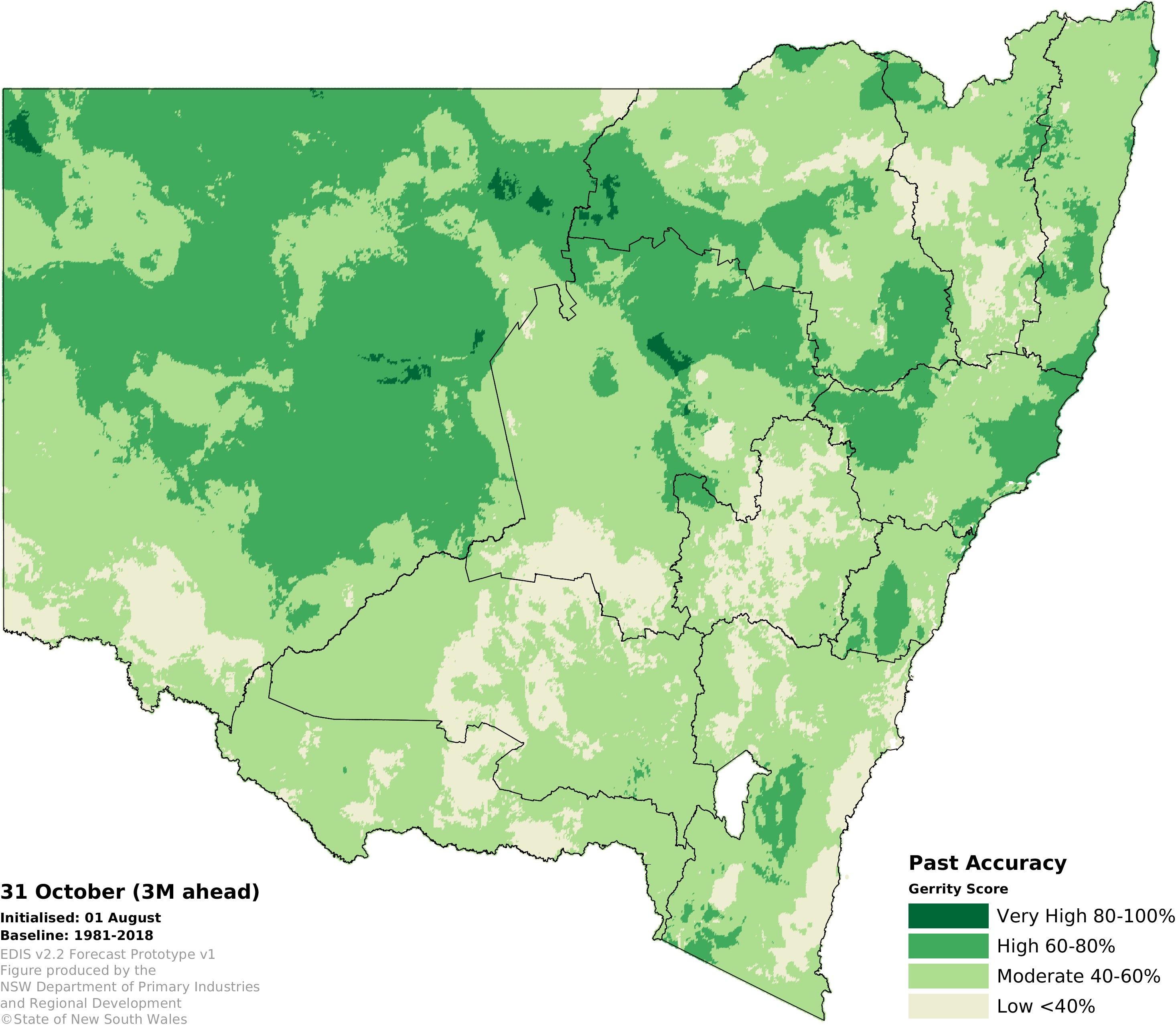
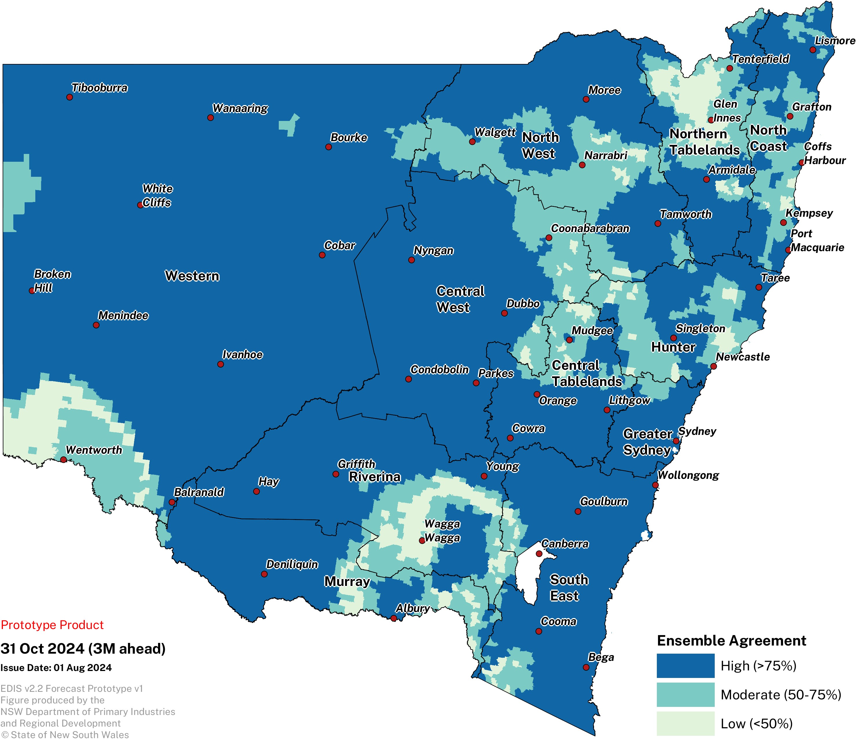
Water availability remains highly variable across NSW.
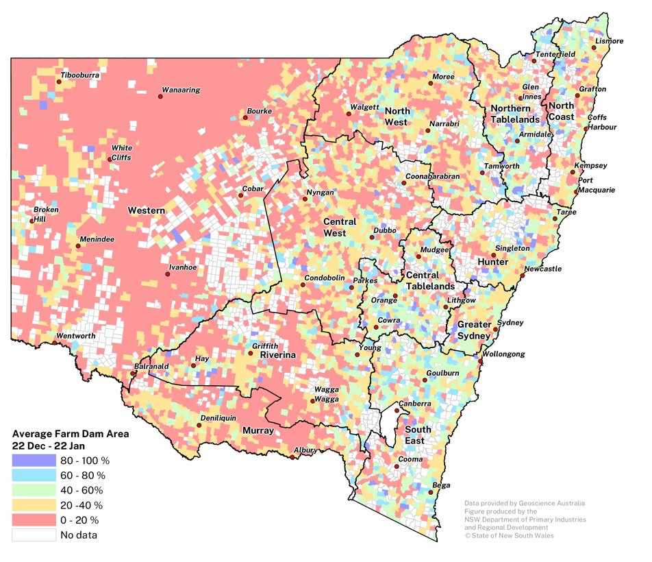
The Farm Dam Water assessment draws on the DEA Waterbodies product which detects all water bodies in the size range of 3125 m2 – 10 km2. Landsat remote sensing data is used to compare the current water surface area in each water body to the maximum extents on record between the year 1987 and present. Large storages that are potentially part of irrigation schemes or river reaches are excluded from the analysis. This provides monitoring of around 50,000 farm dams each month.