September 2024
El Niño–Southern Oscillation (ENSO)
- The Bureau of Meteorology’s (BoM) El Niño-Southern Oscillation (ENSO) status remains neutral, and the outlook remains at La Niña WATCH (issued 1 October 2024).
- Atmospheric indicators such as cloudiness, trade winds and pressure have become more consistent with a La Niña in recent weeks.
- The BoM surveyed 6 climate models, and three suggest sea surface temperatures (SSTs) in the tropical Pacific Ocean are likely to exceed the La Niña threshold from October, while the other 3 models forecast SSTs to fall just below the threshold. All models forecast ENSO neutral conditions by February 2025.
- ENSO forecast skill is high at this time of year (up to 4 months ahead).
Model agreement
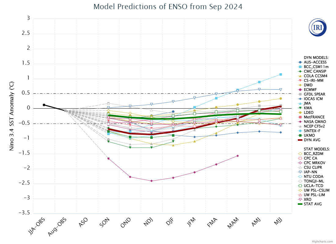
- The figure below shows forecasts from international models for sea surface temperature anomalies in the Niño 3.4 region for 9 overlapping 3-month periods (sourced 1 October 2024). For more information on this figure visit the Columbia International Research Institute for Climate and Society website.
- There is wide variation in the model forecasts, particularly across the longer timeframes. Most of these models suggests neutral or La Niña conditions over the coming months.
- The skill of the forecasts generally decreases the further in advance the forecast period.
- Note that the threshold used by the American meteorological agencies used to indicate a La Niña state is -0.5°C where the Bureau of Meteorology threshold is -0.8°C.
- DPIRD’s advice is to continue to monitor conditions closely over the coming months and refer to the wider variety of indicators and thresholds used by the Australian Bureau of Meteorology to track ENSO and its impacts on seasonal climate in Australia