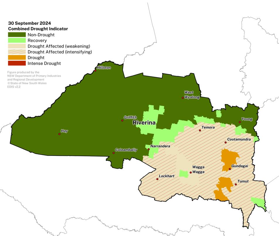
September 2024
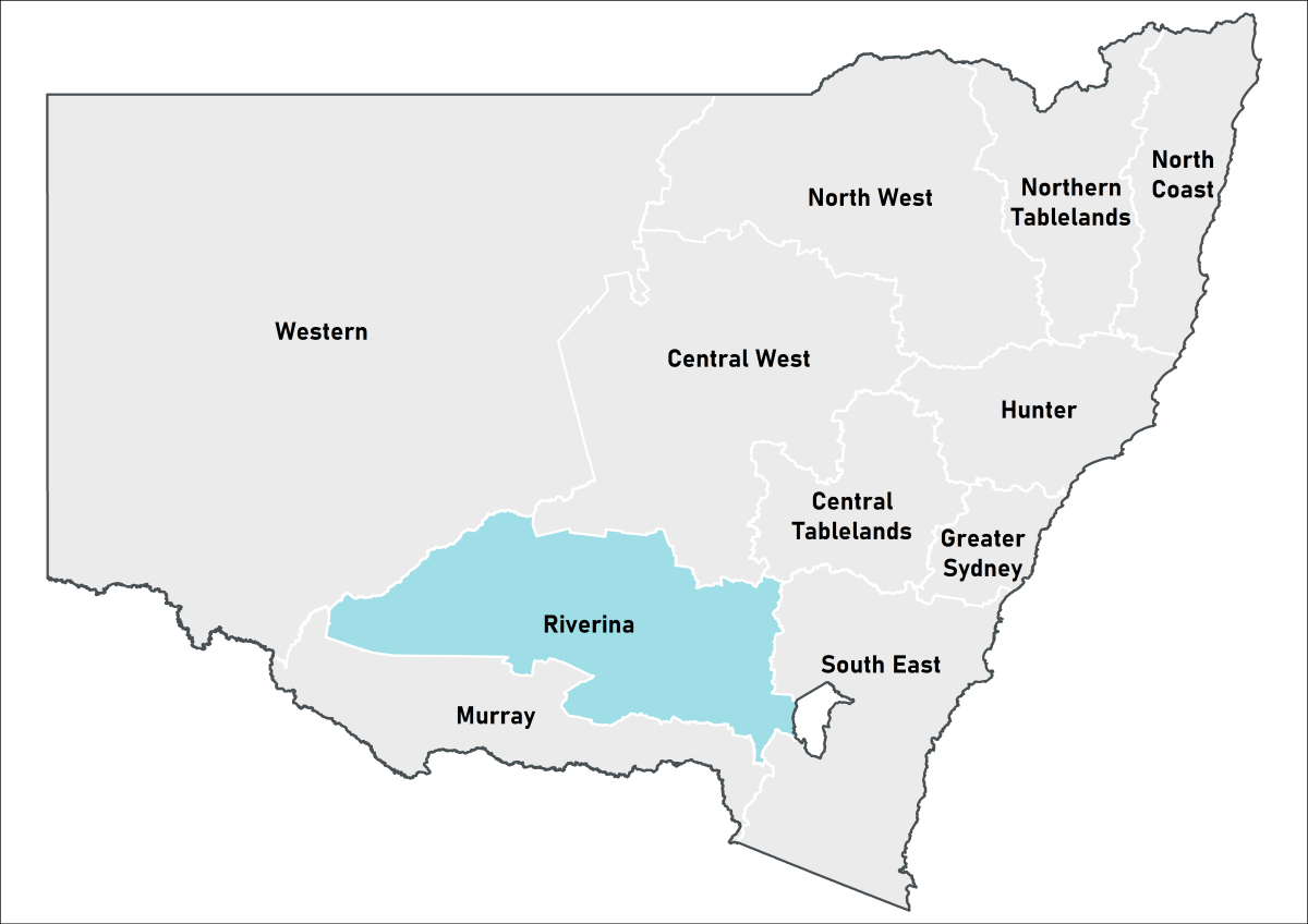 Riverina Local Land Services
Conditions and outlooks are positive in the west of the region; conditions are steady in the east.
- The Combined Drought Indicator (CDI) shows approximately 32% of the region is in one of the drought categories at the end of September.
- Rainfall was average to below average across the region during September, continuing the longer-term rainfall deficits experienced this year.
- Rainfall, particularly in the last week of September has helped to maintain pastures and crops and ease conditions, with totals up to 50mm received.
- Very cold temperatures and still dry atmospheric conditions have led to widespread frost events across parts of the region.
- On ground reports suggest cereal and oilseed crops have been frost damaged, particularly in lower lying areas, with some canola crops already cut for hay. Recent rainfall in late September may help other crops recover and reach maturity for harvest.
- There are also some frost impacts in horticultural and viticultural production areas.
- Other areas continue to report good production outlooks, with crops responding well to good levels of soil moisture and timely and effective rainfall events.
- Producers continue to monitor forecasts closely and are implementing farm management strategies in line with conditions, with a focus on crop inputs, feed budgeting, fodder production and livestock health.
- The DPIRD continues to closely monitor conditions in this region.
Click on the scroll bar below the map to compare with previous months.
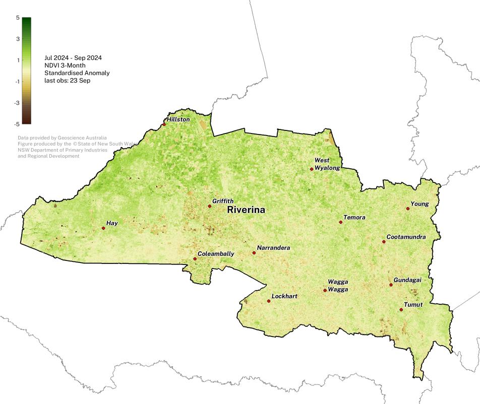
Normalised Difference Vegetation Index
Plant greenness levels have improved but remain variable across the region for the July to September period.
Note that some of the extremely negative NDVI areas (brown patches) are water bodies.
The NDVI anomaly is a useful measure of vegetation density and plant health. It estimates the amount of green vegetation there is in the landscape compared to what is expected at the given time of year, against the baseline period 1987 - 2020.
Click on the scroll bar below the map to compare with previous months.
Individual Drought Indicators
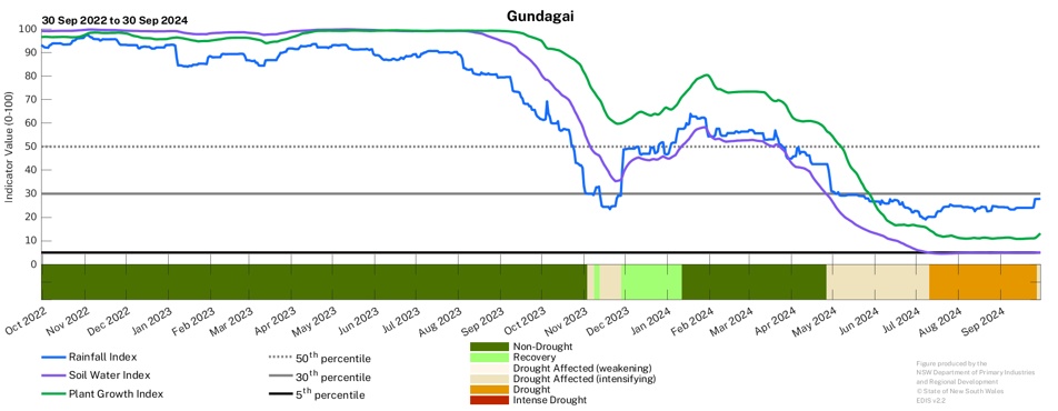
Drought indicators continue to remain low in the east
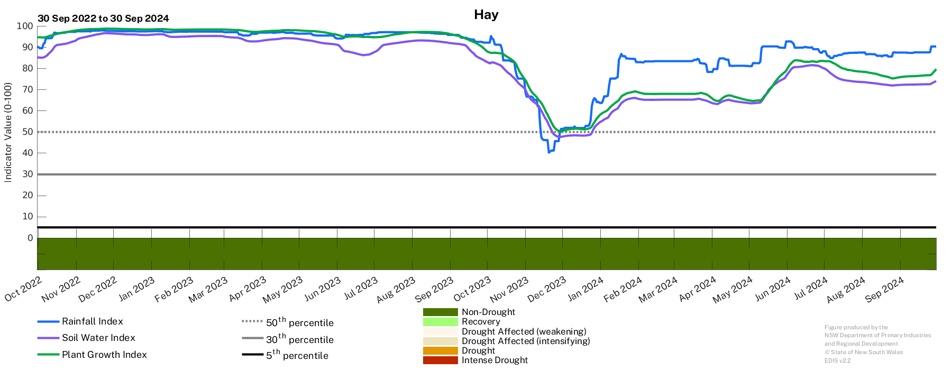
- Drought indicators are steady in the west, after recent declines in some areas over the last few months.
- The drought indicator values continue to remain low in the east, including at Gundagai.
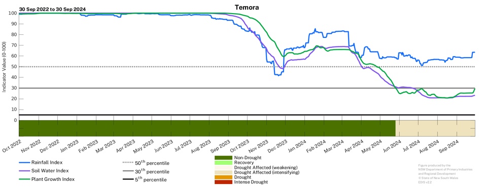
- The soil water and plant growth indicators have stabilised at Temora, while the rainfall indicator remains high.
- Timely and effective follow up rainfall will be crucial over the coming months entering summer, particularly in the east of the region.
To access a Drought History chart for your Parish, visit the Seasonal Conditions Information Portal.